Ideas for Great Smokey Mountains
The Great Smokey Mountains National Park is is one of the jewels of the park system. It is the most bio-diverse ecosystem in the northern hemisphere anywhere north of the tropics themselves. More than 4,000 species of plants grow there. It has more tree species than found in the whole of Europe. It has 16 trees that are larger than any others of their kind on the earth. The west side of the park is the largest unsegmented area without roads in the eastern U.S. It contains the most remote parts of the Appalachia Trail.

Click for Large format PDF map of hiking trails
Click below for flights into Knoxville TN
From Msp
From PHX
From Cedar Rapids
From Rapid City
View Larger Map
Click here for the Wikipedia page about Gatlinburg
Gatlinburg tourism web site
Now to the Park itself...
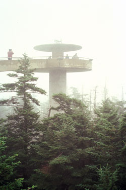
Trails.com says the 'must hike' (not really a hike) is from Newfound Gap to the Observation Tower on Clingmans Dome. The observation tower provides great views of the park. It is a .5 mile hike, but it is at the end of a seven mile spur. Be prepared for traffic.


Hike To:
Mt. LeConte via Alum Cave Trail
There are two parking lots at the trailhead, but you must arrive early in the morning to get a parking spot. It is located 8.7 miles from the Natl Parks Sugarlands Visitor Center
At 6200 feet, Mt Lonte is the third highest mountain in Tennessee.
The most scenic, shortest and steepest trail to Mt LeConte is the Alum Cave Trail.

Round-Trip Length: 10.1 miles
Elevation Change: +2,728' net gain
Skill Level: Moderately Strenuous


www.gsmnp.com
www.leconte-lodge.com
wikipedia
localhikes.com
romanticasheville.com


Newfound Gap to Charlies Bunion (Appalachian Trail)
"Wow....only the perfect hike for the novice hiker and the weathered outdoorsman
From Backpacker.com
Roundtrip Length:  8.1 miles
Total Elevation Gain:  1640 feet
Skill Level: strenuous
View Larger Map

Clingmans Dome to Silers Bald

Roundtrip Length: 9.88 miles
Total Elevation Gain: 21 feet
Skill Level: 5 (medium)

Cucumber Gap Loop

Roundtrip Length: 5.6 Miles
Total Elevation Gain: 830 Feet
Skill Level: 7.26 (moderate)

